Norumbega: The Lost City That May Lie Beneath Bangor
El Dorado, Atlantis and Norumbega. These are all mythical places in history where explorers came across magnificent places, documented their stories of outlandish findings and have left mystery behind while others tried to find these mystical places.
And one of those mythical places could have stood in the same place that the City of Bangor stands today.
In the mid-1500's a cosmographer by the name of André Thévet ventured throughout was is now New England and Eastern Canada and came across a French Fort called 'Norombégue'.
Early visitors of this mythical city mentioned the location featured 'a New World city where homes were said to have pillars of gold and natives carried quarts of pearls on their heads'.
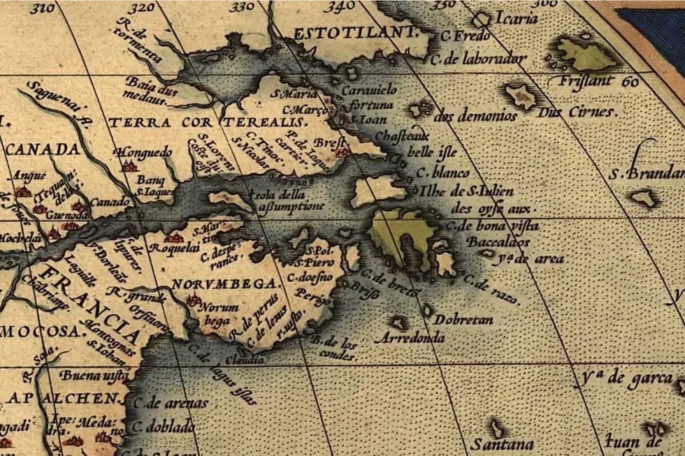
The mythical city is shown at the crux of a river in the land between what is now the St. Lawrence River and the Atlantic Ocean, though the accuracy of the map makes it hard to place where exactly this river and lost city were actually located. This city is noted on many early maps from the 1500s of northeastern North America, including a 1570 atlas created by Abraham Ortelius (see below) as well as on a 1529 map of America by Giovanni da Verrazzano where the mythical city is called 'Oranbega'.
Another spelling of the name in other documents include Nurembega.
Bangor is one of the many locations thought to be where this mythical city is located. Bangor has commemorated the legend with our Norumbega Hall, which was once a municipal hall. You can also see the nod in other Maine locations including Norumbega Mountain in Acadia National Park and a mansion built in Camden called Norumbega Castle, owned by Maine inventor Joesph Barker Stearns.
Who exactly built the city is not quite clear but, a 19th century scholar by the name of Eben Norton Horsford denoted Vikings as part of the settlement.
Scholar Eben Norton Horsford theorized that the settlement was located in modern day Massachusetts, along the Charles River and not in Maine along the Penobscot River.
Ghost Kitchens of the Bangor Area
Native American Meanings Behind the Names of Maine Locations & Features
11 Weird Mainer Things Sold On Etsy
More From WBZN Old Town Maine


