Despite Wet Weather, Much of Maine in High Fire Danger
According to the Maine Forestry Service's website, only the very Northern part of Maine is out of the danger zone, the fire danger zone, that is.
This is curious since we've rarely seen the sun this month, that there have multiple examples of flooding throughout the state and rain has been much more prevalent than any other weather condition in recent weeks. But, nonetheless, this is where we are for the last week of April: a little but of sun (finally) and a whole lot of fire danger.
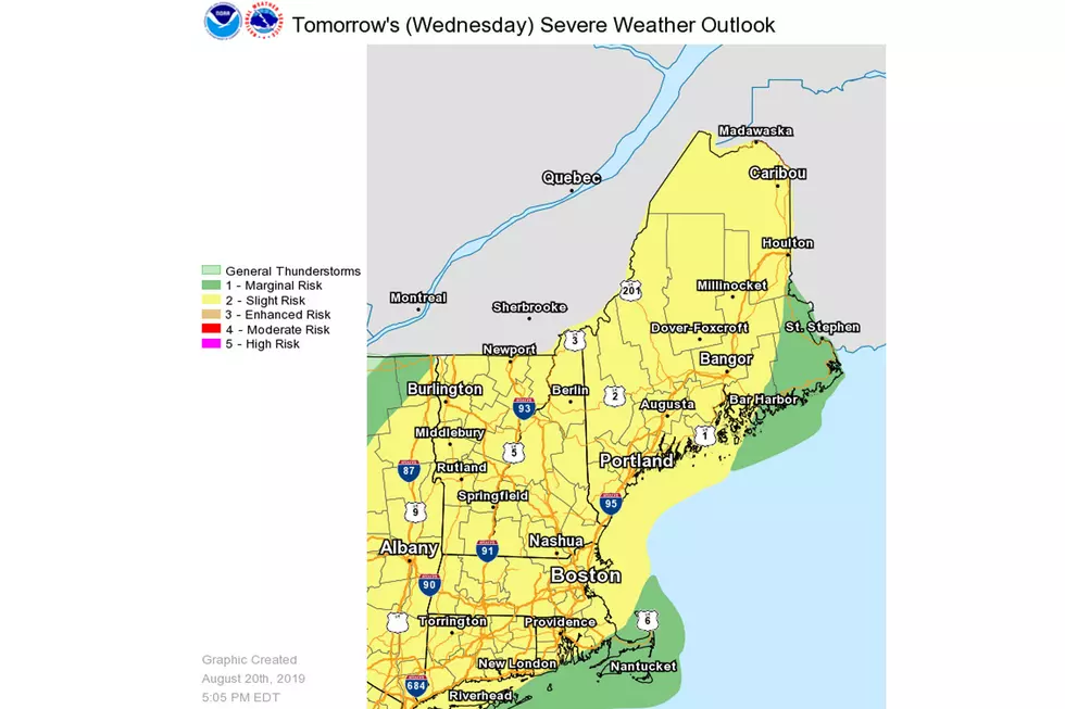
Maine.gov describes the levels of each level with a color coded system scaling the danger by color, red being extreme danger down to green being a low level of danger.
Most of Maine lies in the orange 'Very High' danger level meaning a fire could start very easily and spread fast. Here's the definition given by Maine.gov:
Fires start easily from all causes, and immediately after ignition, spread rapidly and increase quickly in intensity. Spot fires are a constant danger. Fires burning in light fuels may quickly develop high-intensity characteristics; such as, long-distance spotting and fire whirlwinds, when they burn into heavier fuels. Direct attack at the head of such fires is rarely possible after they have been burning more than a few minutes.
The Maine Emergency Management Agency posted the map on Facebook stating: "Here is the predicted wildfire danger map for today."
Maine weather... you just can't wrap your mind around it even if you try.
For more info about Maine fire reports, check out the Maine.gov website.
More From WBZN Old Town Maine


![Frankie MacDonald’s Winter Forecast [VIDEO]](http://townsquare.media/site/495/files/2019/05/FRANKIE3.jpg?w=980&q=75)
![The Correct Way To Clean Snow Off Your Car [VIDEO]](http://townsquare.media/site/495/files/2019/02/snow-clean.jpg?w=980&q=75)