Map Shows Where ‘Forever Chemicals’ Are Identified In Maine
The Maine Department of Environmental Protection has an interactive map that shares various pieces of information being monitored by the state. Some of these icons share businesses that the Maine DEP monitors, other icons show a history of the State of Maine when it comes to waste, spills and other concerning environmental factors, including 'forever chemicals', known as PFAs.
What are PFAs?
PFAs are a large group of manmade substances (Perfluoroalkyl and polyfluoroalkyl substances) that have been used since the 1950's that are linked to many kinds of cancers in humans. Some PFAs take a really long time to break down and are found in water, wildlife and humans.
Mainers Informed of PFA sites
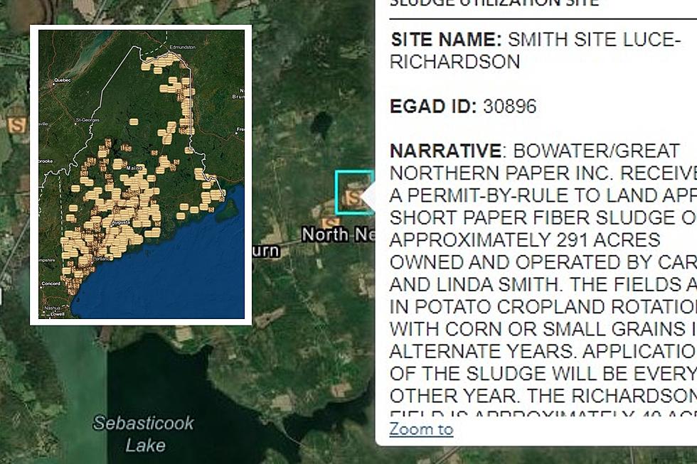
As a consumer, you want to know where these chemicals are in the state you live in. The map shares detailed information including EGAD Septage and Sludge Sites where PFAs have been found.

Clicking the various icons allows for a more informational look at the environment around us, statewide and next door. Here is what the map looks like for various areas throughout the State of Maine. To be able to find information about the visuals below, check out the Maine Department of Environmental tool accessible to anybody with an internet connection.
Identified Portland Area PFA Sites

Identified Lewiston Area PFA Sites

Identified Bangor Area PFA Sites

Identified Waterville Area PFA Sites

Identified Caribou Area PFA Sites

Identified Bucksport/Belfast Area PFA Sites

30 Bangor Area Mom-and-Pop Convenience Stores
The 25 Oldest Homes In Maine
Top 25 Stories In Bangor In 2021
RANKED: Here are the most popular national parks
More From WBZN Old Town Maine

